


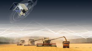
The Andhra Pradesh Chief Minister has launched a satellite-based crop mapping initiative aimed at transforming the state’s agricultural landscape. This new system uses remote sensing, drone technology, and GIS tools to conduct accurate digital crop surveys across districts. By mapping cropping patterns and linking data to Aadhaar and land records, the state aims to eliminate fraudulent claims and ensure that genuine farmers receive proper support. This project will also facilitate faster crop insurance, subsidy disbursement, and targeted minimum support price (MSP) procurement. The digital agriculture initiative promises real-time monitoring of farm activity, helping in policy-making and providing precise advisory services. Andhra Pradesh is aligning this move with the national Digital Agriculture Mission, aiming for full implementation by the Kharif 2025 season. This step is expected to significantly increase farmer income, reduce wastage, and bring transparency to agricultural governance using cutting-edge satellite technology.
#AndhraPradesh

#SatelliteCropMapping
#DigitalAgriculture
#FarmerIncome
#RemoteSensing
#CropSurvey
#GISinAgriculture
#DroneTechnology
#LandRecords
#AadhaarLinkage
#CropInsurance
#AgriculturalSubsidy
#MinimumSupportPrice
#DigitalIndia
#Kharif2025
#AgriculturalReforms
#SmartFarming
#PrecisionFarming
#Agritech
#FarmerSupport