


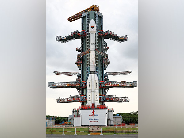
On July 30, 2025 at 17:40 IST, ISRO’s GSLV‑F16 will launch the pioneering NASA‑ISRO Synthetic Aperture Radar (NISAR) satellite from Sriharikota’s Satish Dhawan Space Centre. Weighing 2,392 kg, NISAR deploys dual‑frequency radar—NASA’s L-band and ISRO’s S-band—on a 12‑metre unfurlable mesh reflector integrated onto ISRO’s modified I3K bus, leveraging SweepSAR technology for unprecedented resolution and coverage .
Planned for a 743 km sun‑synchronous orbit at 98.4° inclination, NISAR will deliver global scans every 12 days, capturing all‑weather, day‑and‑night imagery across a 242 km swath with 5–10 m ground resolution . After launch, the satellite enters a 90‑day commissioning phase before initiating the science phase, where data will support earthquake and landslide monitoring, glacier and sea‑ice tracking, soil moisture mapping, vegetation change detection, coastal surveillance, and disaster relief planning .
This landmark Indo‑US collaboration, a decade in the making, marks the most expensive Earth‑observation mission—valued at $1.5 billion—and strengthens global capacity for climate research and environmental monitoring . NISAR’s high‑resolution radar data will democratize access to vital geospatial intelligence, benefiting scientists, policymakers, and disaster‑response teams worldwide.

#NISAR
#ISRO
#NASA
#EarthObservationSatellite
#GSLVF16
#SweepSAR
#ClimateMonitoring
#DisasterResponse
#AllWeatherImaging
#SunSynchronousOrbit